
File:Philippines relief location map (Mindanao).svg

Size of this PNG preview of this SVG file: 656 × 486 pixels. Other resolutions: 320 × 237 pixels | 640 × 474 pixels | 1,024 × 759 pixels | 1,280 × 948 pixels | 2,560 × 1,897 pixels.
Original file (SVG file, nominally 656 × 486 pixels, file size: 2.21 MB)
| This is a file from the Wikimedia Commons. Information from its description page there is shown below. Commons is a freely licensed media file repository. You can help. |
.svg)
Summary
| Description |
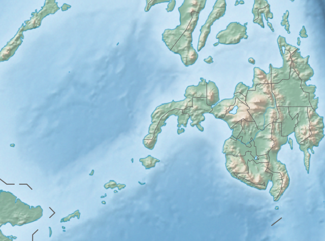
English: Physical location map of the Philippines (Mindanao)
Equirectangular projection based on the parallel of 10°43' N
|
| Date | |
| Source | File:Philippines location map (square).svg |
| Author | User:Hellerick |
| Other versions |
This file was derived from: Philippines relief location map (square).svg: .svg) |
.svg)
Licensing
This file is licensed under the Creative Commons Attribution-Share Alike 3.0 Unported license.
- You are free:
- to share – to copy, distribute and transmit the work
- to remix – to adapt the work
- Under the following conditions:
- attribution – You must give appropriate credit, provide a link to the license, and indicate if changes were made. You may do so in any reasonable manner, but not in any way that suggests the licensor endorses you or your use.
- share alike – If you remix, transform, or build upon the material, you must distribute your contributions under the same or compatible license as the original.
File history
Click on a date/time to view the file as it appeared at that time.
| Date/Time | Thumbnail | Dimensions | User | Comment | |
|---|---|---|---|---|---|
| current | 14:36, 27 October 2017 | | 656 × 486 (2.21 MB) | Mliu92 | Updated crop to add missing island. |
| 17:23, 26 October 2017 |  | 573 × 573 (2.21 MB) | Mliu92 | User created page with UploadWizard |
File usage
More than 100 pages use this file. The following list shows the first 100 pages that use this file only. A full list is available.
.svg)
- 1879 Surigao earthquake
- 1897 Mindanao earthquakes
- 1918 Celebes Sea earthquake
- 1955 Lanao earthquake
- 2010 Mindanao earthquakes
- 2017 Surigao earthquake
- 2019 Cotabato earthquakes
- 2019 Davao del Sur earthquake
- 2021 Davao Oriental earthquake
- 2021 Davao del Sur earthquake
- Agus River
- Agusan Dam
- Agusan Marsh Wildlife Sanctuary
- Agusan River
- Allah River
- Andanan River
- Aragon Dam
- Arakan River
- Bantac River
- Basilan Strait
- Bobonawan River
- Boguko River
- Bud Dajo
- Buluan River
- Butuan Bay
- Cagayan River (Mindanao)
- Camp Abubakar
- Camp General Basilio Navarro
- Davao Gulf
- Davao River
- Digos River
- Dinagat Island
- Dumanquilas Bay
- Hinatuan Enchanted River
- Iligan Bay
- Illana Bay
- July 2019 Cotabato earthquake
- Kabacan River
- Kalabugao River
- Lake Buluan
- Lake Butig National Park
- Lake Dapao
- Lake Lanao
- Lake Wood (Philippines)
- Laminusa Island
- Latukan
- Leonard Kniaseff
- Libungan River
- M'lang River
- Macajalar Bay
- Mado Hot Spring National Park
- Malitubog River
- Manupali River
- Maradugao River
- Maramag River
- Marbel River
- Moro Gulf
- Mount Agad-Agad
- Mount Apo
- Mount Balatukan
- Mount Baya
- Mount Bongao
- Mount Butung
- Mount Diwata
- Mount Dulang-dulang
- Mount Hamiguitan
- Mount Hibok-Hibok
- Mount Kalatungan
- Mount Katanglad
- Mount Kitanglad
- Mount Makaturing
- Mount Malindang
- Mount Matutum
- Mount Sibulan
- Mount Sumagaya
- Mount Tagubud
- Muleta River
- Murcielagos Island
- Musuan Peak
- Panguil Bay
- Pantuwaraya Lake National Park
- Pujada Bay
- Pulangi Dam
- Pulangi River
- Rio Grande de Mindanao
- Rungkunan National Park
- Sacred Mountain National Park
- Salikata National Park
- Sibagat River
- Sibuguey Bay
- Simuay River
- Sitangkai Island
- Sulu Sea
- Tago River
- Tagoloan River
- Tambagoko River
- Tigwa River
- Timpoong and Hibok-Hibok Natural Monument
- Wawa River (Agusan del Sur)
- Zones of Joint Cooperation (Mindanao)
View more links to this file.
Global file usage
The following other wikis use this file:
- Usage on bcl.wikipedia.org
- Usage on bn.wikipedia.org
- Usage on fa.wikipedia.org
- Usage on fr.wikipedia.org
- Usage on id.wikipedia.org
- Usage on ilo.wikipedia.org
- Baybay Bohol
- Karayan Cagayan (Mindanao)
- Karayan Mindanao
- Karayan Tagoloan
- Karayan Agusan
- Karayan Davao
- Danaw Leonard
- Golpo Moro
- Modulo:Mapa ti lokasion/datos/Mindanao
- Modulo:Mapa ti lokasion/datos/Mindanao/dok
- Luek Iligan
- Luek Illana
- Luek Sibuguey
- Luek Panguil
- Danaw Lumao
- Danaw Dasay
- Danaw Napalit
- Danaw Pinamaloy
- Danaw Wood (Filipinas)
- Danaw Apo
- Lingsat Basilan
- Luek Butuan
- Luek Dumanquilas
- Luek Macajalar
- Masna a Monumento ti Timpoong ken Hibok-Hibok
- Danaw Lanao
- Danaw Buluan
- Bantay Butung
- Bantay Baya
- Bantay Kitanglad
- Luek Pujada
- Bantay Hamiguitan
- Bantay Bongao
- Usage on ja.wikipedia.org
View more global usage of this file.
.svg)
.svg)